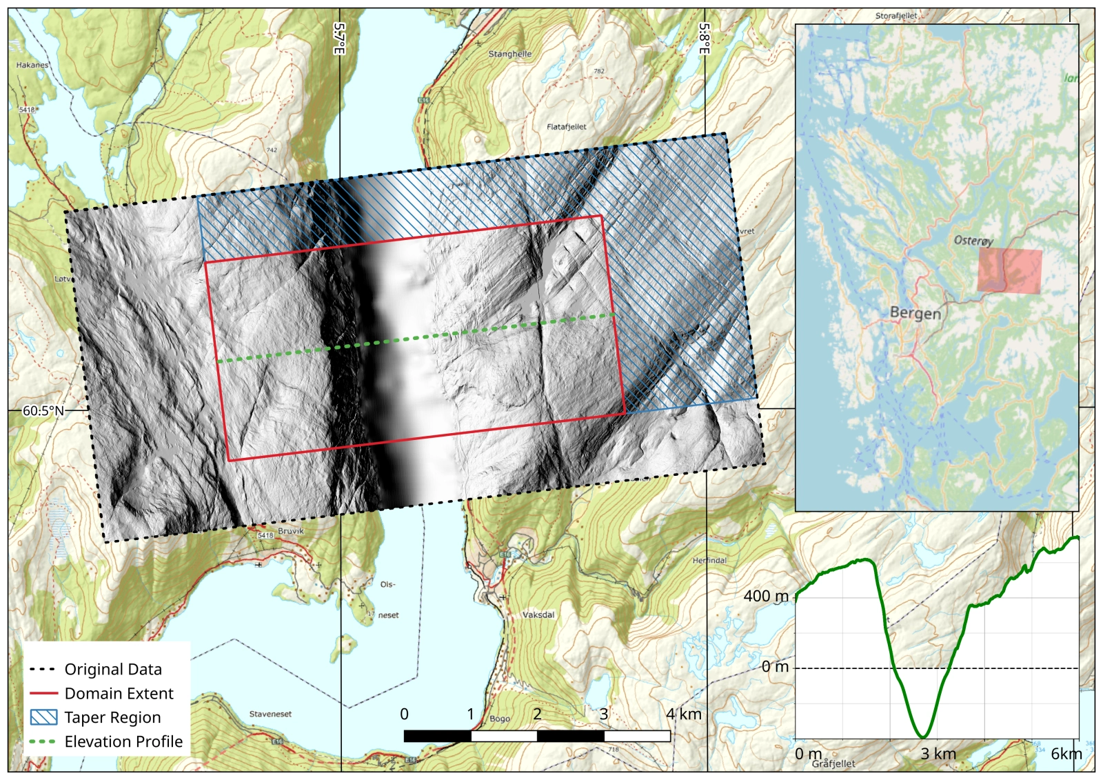
Figure 1. The Veafjorden Domain, Western Norway.
Around twenty thousand years ago, during the last glacial maximum, Norway was completely glaciated. An enormous ice sheet covered Scandinavia and reached most of Northern Europe. The Scandinavian ice sheet was much larger than the ice sheet covering Greenland today, but similar in many ways. As global warming increases, it is vital to understand how large scale ice sheets reacts, moves and flows. It is of special importance to understand how accurate our models and predictions can be. What will Greenland look like after decades and centuries on a warming planet? Studying the Scandinavian Ice Sheet at, and after it's maxima, can be crucial for understanding climate change and the Greenland Ice Sheet.
Veafjorden (Fig. 1), located in Western Norway, just outside Bergen, has provided a puzzle for glaciologist. The bare rock surfaces on the plateaus around show striations perpendicular to the orientation of the fjord below. The striations indicate that ice has moved across the thousand-meter deep through, almost at a 90° degree angle! The question is, what happens to the ice in such a setting? Does it stagnate? Will it slow down? By investigating a small section of the Scandinavian ice sheet, this project aims to gain a deeper understanding of how ice flows over deep fjords and rough terrain.
In Figure 2 some interesting results of the simulations can be seen. Eddy formations spanning the entire fjord creates circular and lateral movement of ice at the location.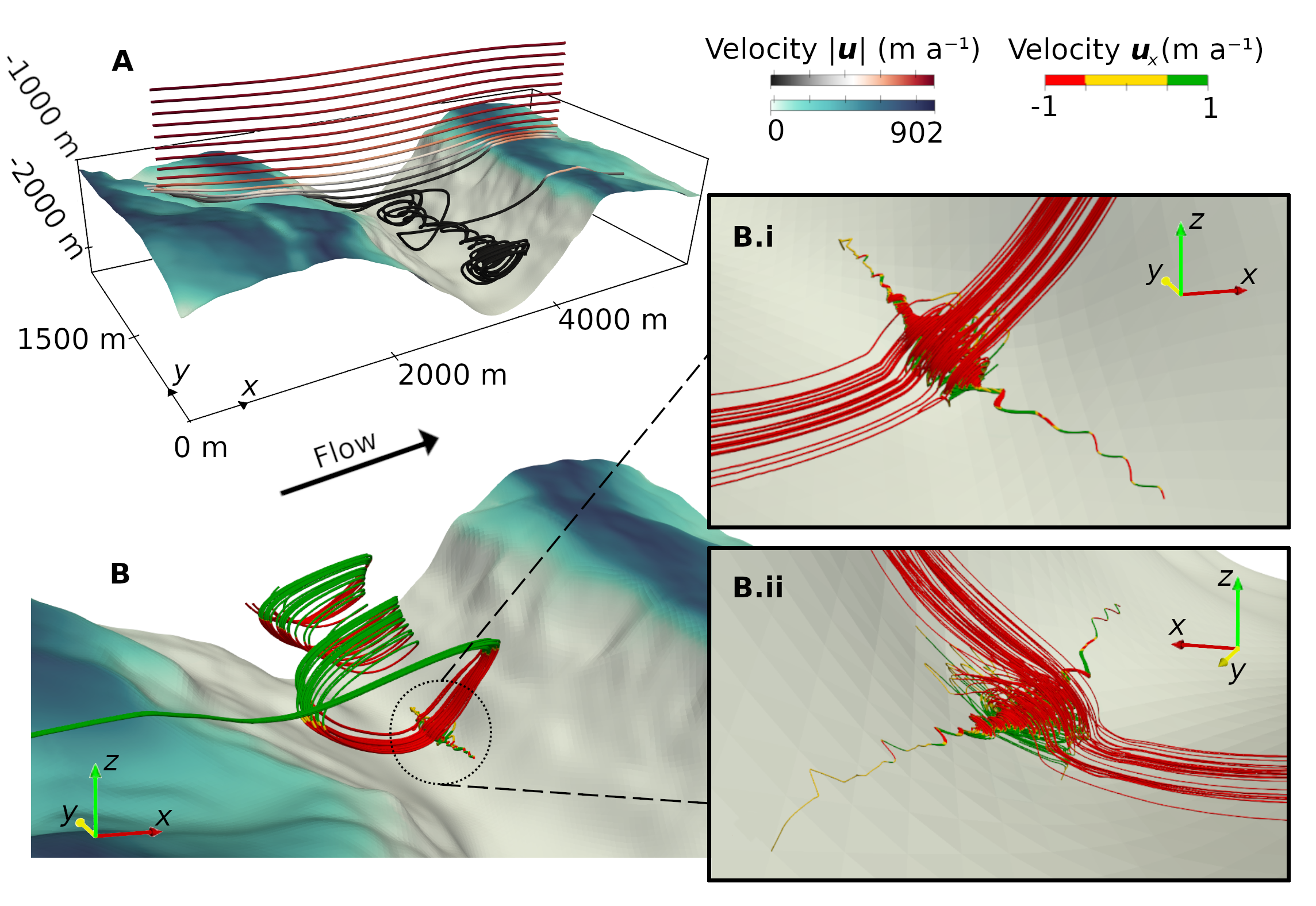
Figure 2. Result of perpendicular ice motion across Veafjorden. Large Moffat eddies form, transporting ice laterally along the fjord.
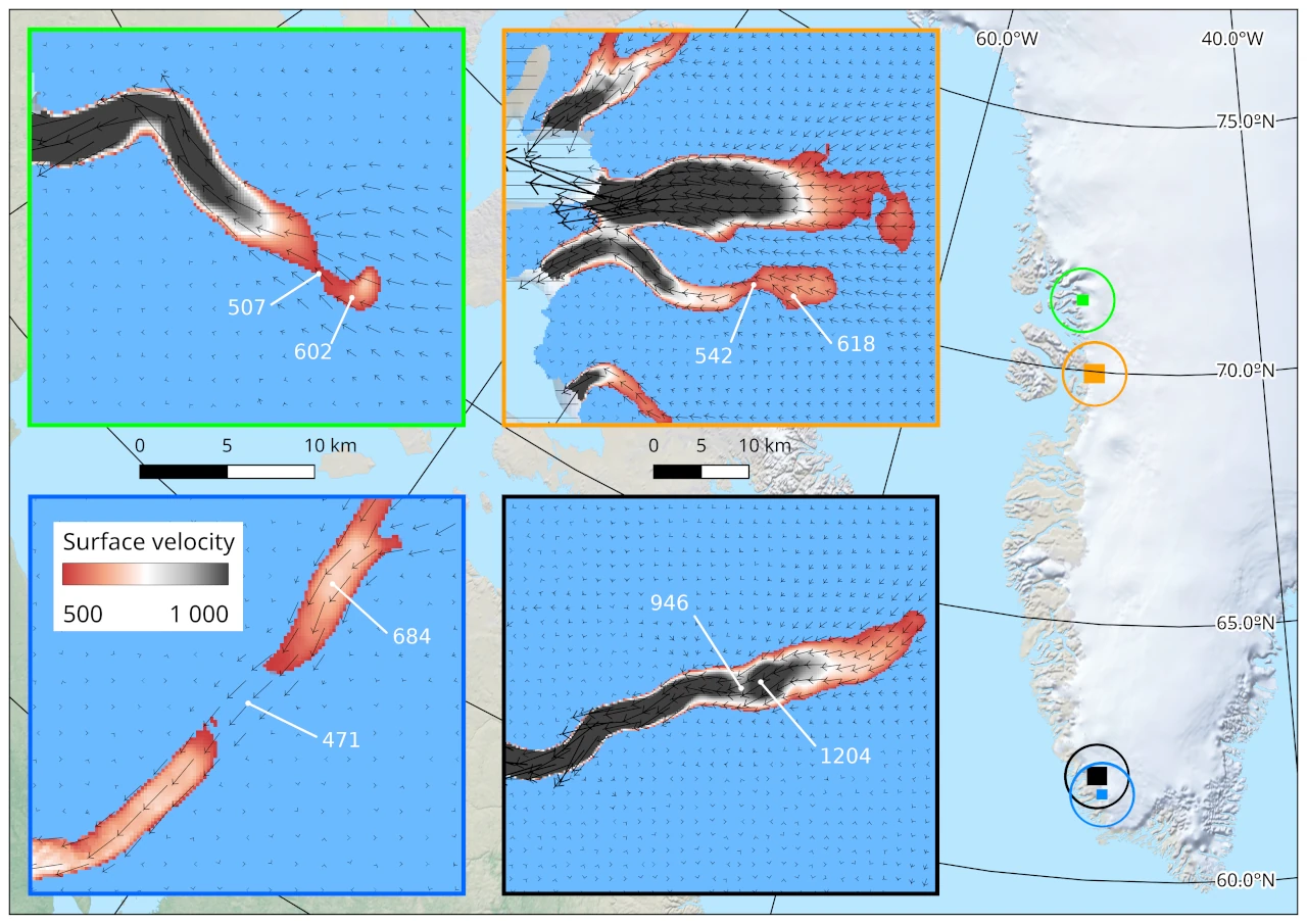
Figure 3. Surface velocity variation along single flow lines at the Greenland Ice Sheet. The values resemble the model results of Veafjorden.
Similar settings likely exist in Greenland today (Fig. 3), but the topography is hidden under thick ice. Several places close to the Greenland coast have the same surface velocity and ice thickness as that of the Veafjorden domain. The presence of velocity reduction and speed up along single flow paths, are consistent with model results of Veafjorden.
One of the most intriguing results are the patterns of flow. In nearly every perpendicular simulation, Veafjorden displays spiralling swirls of slow-moving ice. These spiralising patterns are called Moffatt eddies. Ice from along the plateau base, sinks into the deepest part of the fjord, slowing almost to a halt, spins up again, and down along the fjord (Fig. 2b). The pattern, and the slow-down of ice has an impact on the velocity of the entire system. Ice-sheet simulations using low-fidelity topography would miss these patterns, and overestimate the velocity of the ice sheet.
- Sjur B.
An overview of Vefjorden.